ClIMBING THE 5 HIGHEST PEAKS OF CHIOS IN ONE DAY
This concept took shape about 3.5 months ago when I crafted an infographic showcasing Chios’s tallest peaks in honor of International Mountain Day (December 11th). It was during this time that I discovered something intriguing: the island’s top 5 peaks—Pelineo, Edelos, Harkos, Oros, and Kamenos Lakos—are conveniently clustered together. The first four create the rugged spine of Northern Chios, while Oros sits just slightly to the east.
Can a hiker realistically tackle all five peaks in a single day? Sure, for those who train regularly, such a hike, despite its challenges, isn’t out of reach. But for us average hikers, who simply adore the mountains and prefer to stroll at our own pace, soaking in nature and chatting along the way, is such an adventure doable within a day? It was a thought-provoking challenge that needed an answer.
A preliminary route was sketched out, and after some exploratory contacts, we eventually decided to attempt it on Sunday, March 24, 2024. There were four of us: two seasoned trekkers, Kostas Anagnostou, also known as chiosphotos.gr, and Mikes, a spirited young lad. We set off under clear skies and a gentle breeze at 7:40 a.m. that Sunday, heading towards Spartounta to leave one car at the end of our route. We then returned to Pityos in a second car, where we began our hike.
Our first target was the imposing mt Oros, with the abandoned building of OTE at its summit, at 1,186 meters. We then descended towards the impressive dry stone stockyards – which gradually collapse over time – and passed through Kavernakis, where we encountered the dry, yet unchanged for over 10 years, fallen ‘cedar of Kollaros’.
A preliminary route was sketched out, and after some exploratory contacts, we eventually decided to attempt it on Sunday, March 24, 2024. There were four of us: two seasoned trekkers, Kostas Anagnostou, also known as chiosphotos.gr, and Mikes, a spirited young lad. We set off under clear skies and a gentle breeze at 7:40 a.m. that Sunday, heading towards Spartounta to leave one car at the end of our route. We then returned to Pityos in a second car, where we began our hike
Our first target was the imposing mt Oros, with the abandoned building of OTE at its summit, at 1,186 meters. We then descended towards the impressive dry stone stockyards – which gradually collapse over time – and passed through Kavernakis, where we encountered the dry, yet unchanged for over 10 years, fallen ‘cedar of Kollaros’.
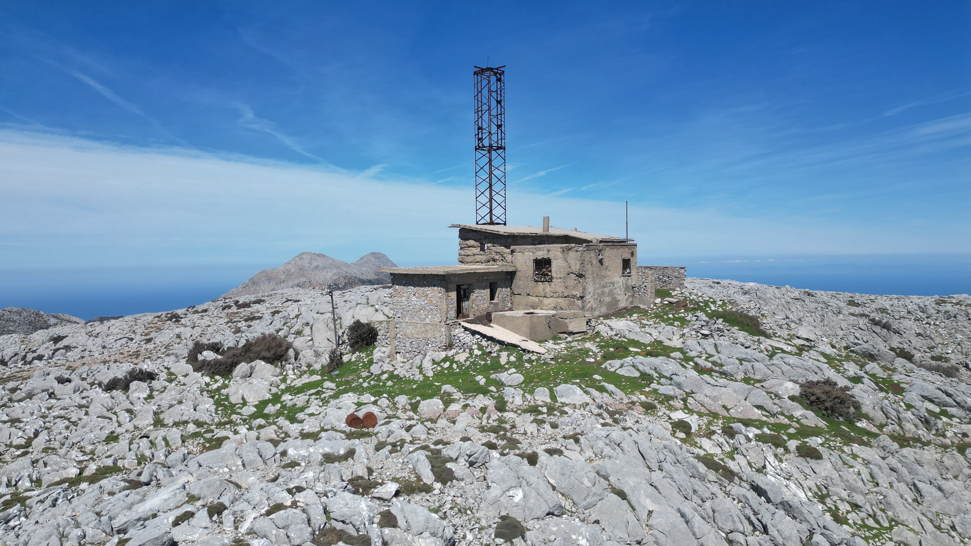
📷 The summit of mt Oros with its abandoned building and the antenna that served Chios’ telecommunications until 1970.
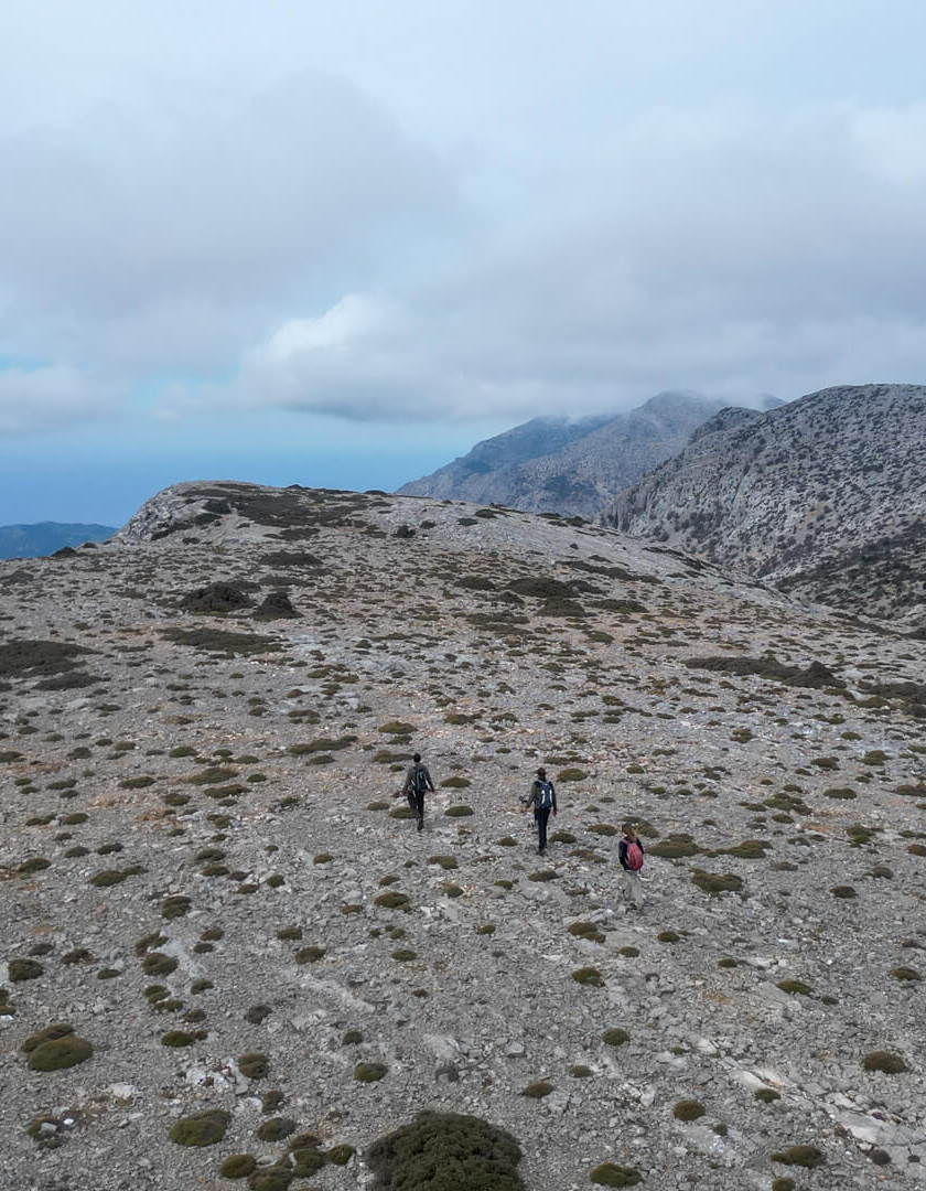
We began our ascent towards Kammenos Lakos, following whatever goat trails we could find, and truth be told, we were quite exhausted by the time we reached Kammenos Lakos, a plateau at 1,126 meters with stunning views of Megalos Gremos (means The Great Cliff) and the villages of Amani. A light mist gradually covered the sky, while the temperature steadily dropped.
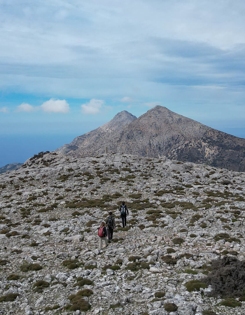
Next in line was mt Charkos, with its reddish slabs and the old trigonometric point at the summit at 1,155 meters. Although our strength was starting to wane, we ascended relatively easily since the elevation gain was minimal. It’s a beautiful mountain, with fascinating geology and breathtaking views
We began our ascent towards Kammenos Lakos, following whatever goat trails we could find, and truth be told, we were quite exhausted by the time we reached Kammenos Lakos, a plateau at 1,126 meters with stunning views of Megalos Gremos (means The Great Cliff) and the villages of Amani. A light mist gradually covered the sky, while the temperature steadily dropped.
Next in line was mt Charkos, with its reddish slabs and the old trigonometric point at the summit at 1,155 meters. Although our strength was starting to wane, we ascended relatively easily since the elevation gain was minimal. It’s a beautiful mountain, with fascinating geology and breathtaking views
📷 Plateau Kamenos lakos
📷 Mt Charkos
We made our way down to the col between Harkos and Pelinnaios. Before reaching Kritikolakkos, we took a break to catch our breath, and another one just above Aggelos. I suggested abandoning the plan and heading down the trail towards Fyta, fearing that nightfall might catch us. It was already past 3 o’clock, we were quite worn out, the cold had become biting, and we only had about 3.5 hours of daylight left, with the imposing bulk of Pelinnaios looming ahead. But my companions were steadfast, ‘We didn’t come this far just to turn back now. Let’s keep going.
We give it our all and head towards Edelos, the toughest peak in Chios at 1,274 meters, where there’s a rudimentary stone shelter, just enough to shield a seated person from the wind. The trail above the pine forest is nearly overgrown. We emerge into the alpine zone and start the traverse. Here, there’s no trail; every step is a struggle, while the wind howls relentlessly, dispelling any thought of launching the drone. We reach the summit, snap a few photos, and quickly make our way down.
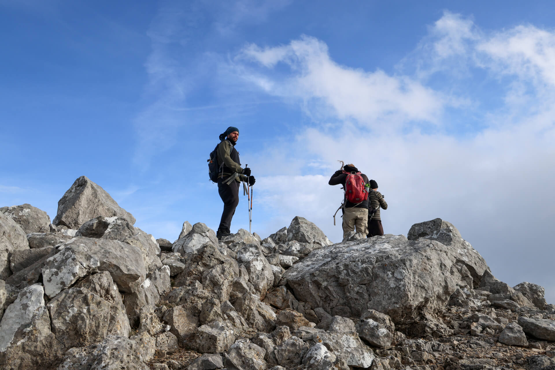
📷 At the summit of Edelos or Kouklia
We continue our journey along the ridge, regaining strength as we approach the mountain massif of Pelinnaios. Just a few meters before the summit, a surprise awaits us. A guy emerges in front of us, behind some steep rocks, above Chaos! ‘How did you end up here?’ I call out to him. ‘I climbed up from a chapel, following a route I found online,’ he said, visibly exhausted. ‘There’s no trail,’ he added. ‘Come with us, let’s all descend together,’ I suggested, something he seemed to accept, perhaps relieved.
We step into the chained metal chapel of Agia Triada and instinctively give each other high fives. Some of us are more tired and colder than others, but our morale, just like throughout the hike, is excellent. We climb up to the trigonometric point at 1,297 meters for the obligatory souvenir photos and descend the steep trail as quickly as we can, eager to escape the cold and the devilish wind.

📷 At the summit of Chios: Pelinnaios peak at an altitude of 1,297 meters.
We reach the dirt road with the last light of the day. The initial plan was to continue all the way to Spartounta via a trail descending from the chapel of Zoodochos Pigi, but given the circumstances, descending to the village with the car of the lone, brave rider turned out to be a convenient shortcut.
For the record, it’s worth noting that for the ascent to the 5 highest peaks of Chios, a route with a total elevation gain of 1,500 meters, we walked just over 17 kilometers in approximately 9 hours, with several breaks for rest, ground, and aerial shots.
Φθάνουμε στον χωματόδρομο με το τελευταίο φως της ημέρας. Ο αρχικός σχεδιασμός προέβλεπε να συνεχίζαμε μέχρι την Σπαρτούντα από μονοπάτι που κατηφορίζει από το ξωκλήσι της Ζωοδόχου Πηγής, αλλά έτσι όπως είχαν έρθει τα πράγματα, η κατάβαση στο χωριό με το αυτοκίνητο του μοναχικού, παράτολμου αναβάτη ήταν ένας βολικός μονόδρομος.
Για την ιστορία να σημειώσουμε ότι για την ανάβαση στις 5 ψηλότερες κορυφές της Χίου, μια διαδρομή με συνολική υψομετρική ανάβαση 1.500 μέτρα, περπατήσαμε λίγο πάνω από τα 17 χλμ σε περίπου 9 ώρες, με αρκετές στάσεις για ξεκούραση, επίγειες και εναέριες λήψεις.