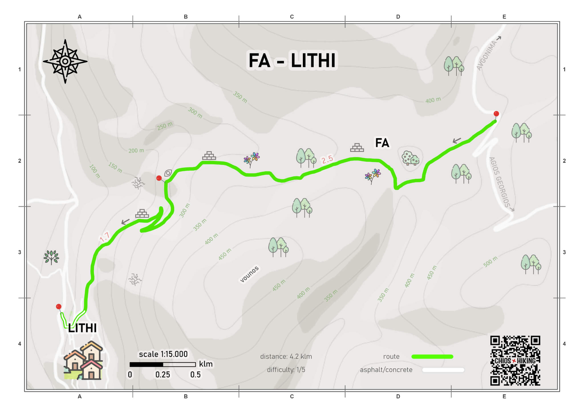
fa - lithi
point to point
altitude difference 300 m
distance 4.2 klm
estimated time 1.5 hour
difficulty 1/5
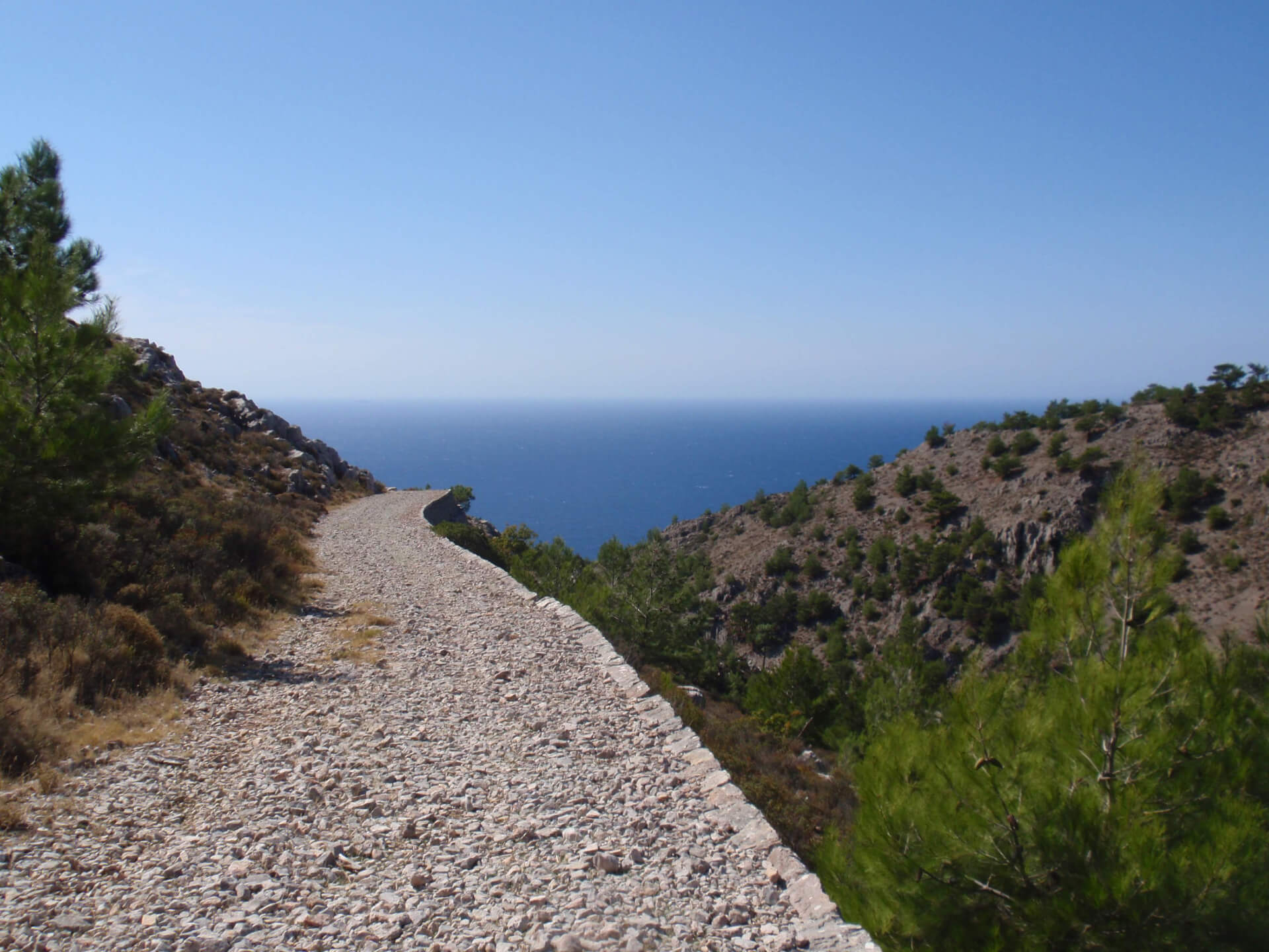
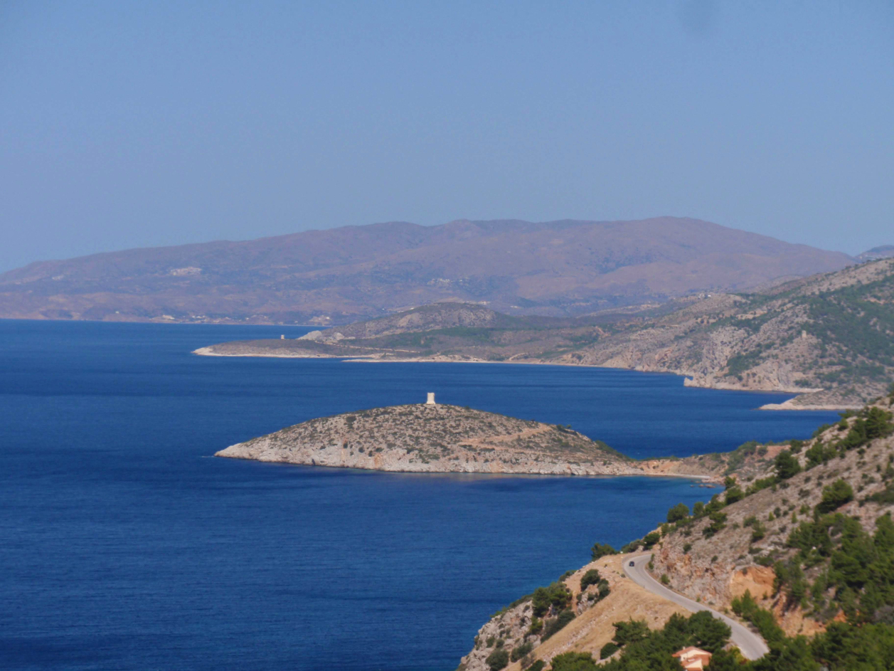
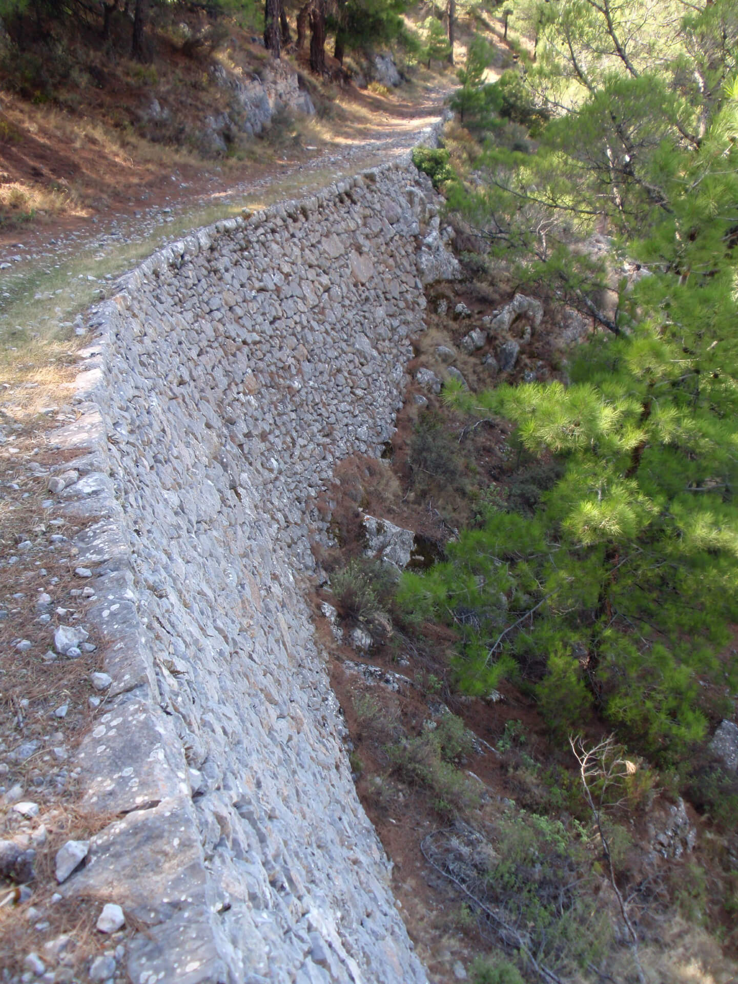
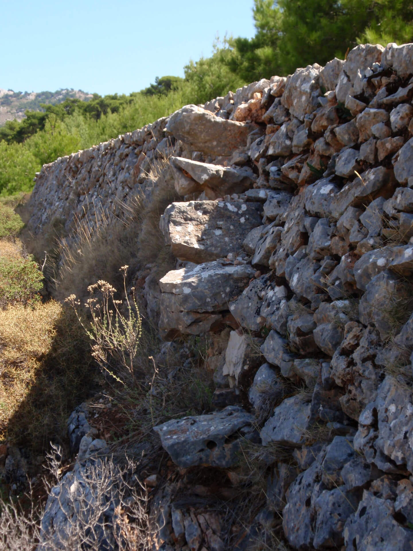
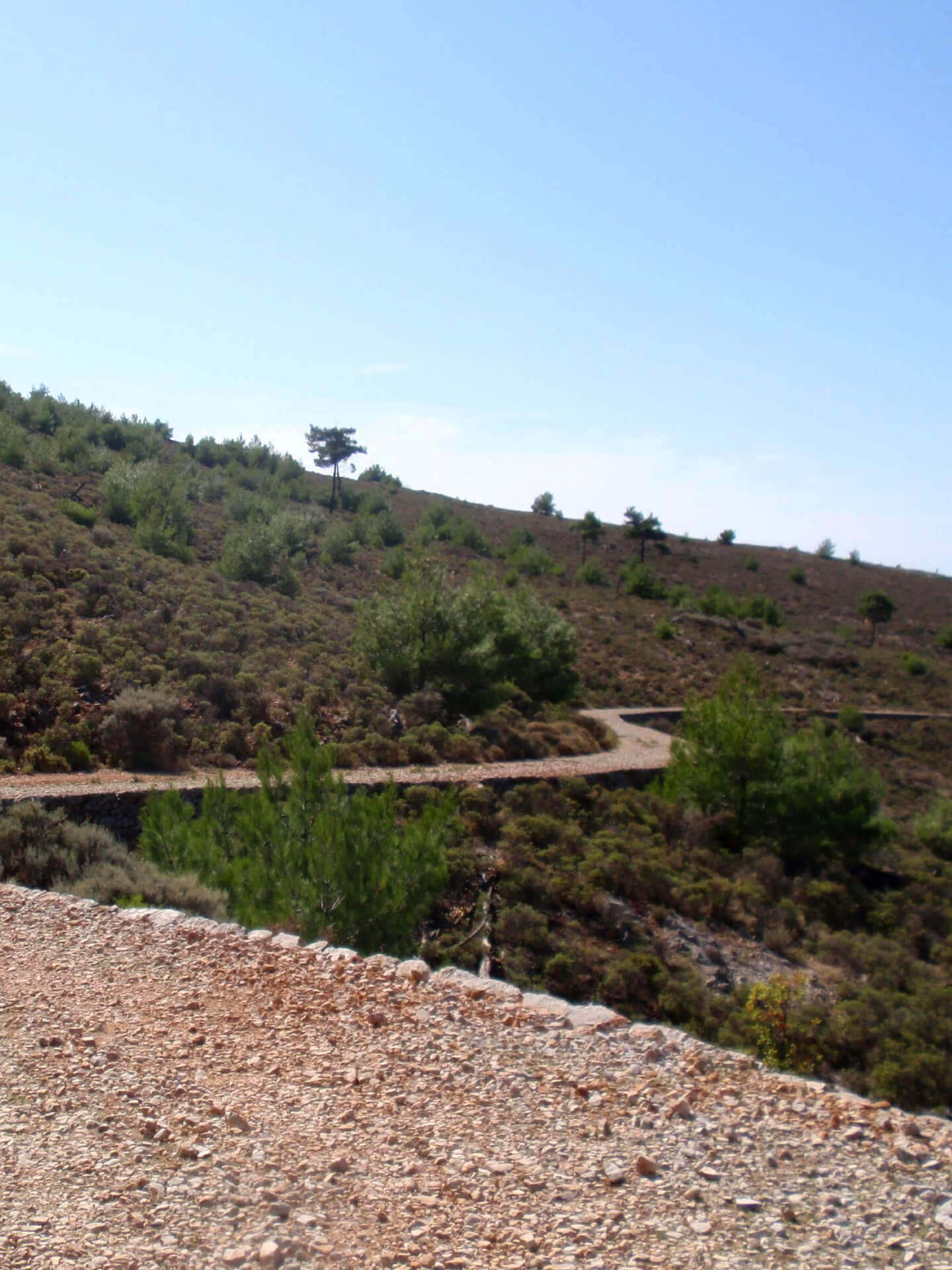
Pleasant, downhill, mostly dirt route on an excellent example of road construction from the post-revolutionary period aiming to facilitate communication between Lithi and central Chios. It is maintained in very good condition, featuring impressive dry stone support, as well as transverse channels for water drainage, while from the middle onwards, it offers a panoramic view of the western shores of Chios.
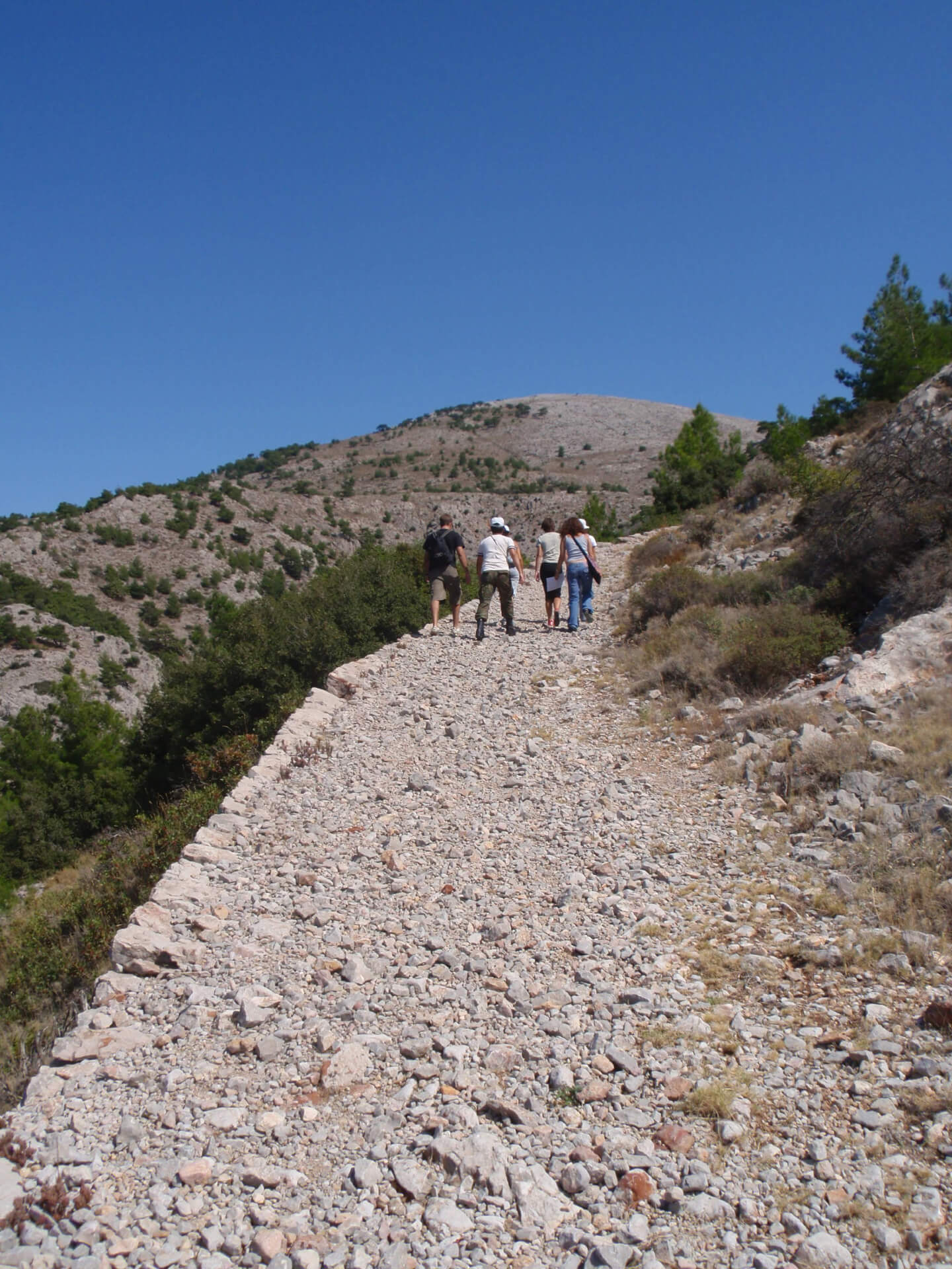
The route starts from the middle of the asphalt road that connects the villages of Avgonima and Agios Georgios Sikousis, at a point where there is a large informational sign. We start our journey on the stone built route, surrounded by scattered pine trees. After a while, we find ourselves in Fa, the small, beautiful plain, where there are cultivated fields with fig trees, olive trees, and almond trees, as well as abandoned ones. Continuing, the sparse forest thins out, and halfway through the route, we enjoy the view towards Lithi, its port, and a large part of the pristine coastline of western Chios. Gradually, the downhill slope intensifies, while two forks add a pleasant change to our walk. Throughout the route in spring, orchids can be found, much to the delight of fans of charming, tiny plants.
Because the route is linear, if you don’t have transportation at the end in Lithi or find the return hike tiring due to the 300-meter elevation difference, you can walk only the first 2.5 km, enjoy the view, and return without walking the last section with the steepest slope.

NEED SOME HELP?
Download the route track on your mobile in gpx or kml format or the map in pdf format, get your friends and let’s go!


