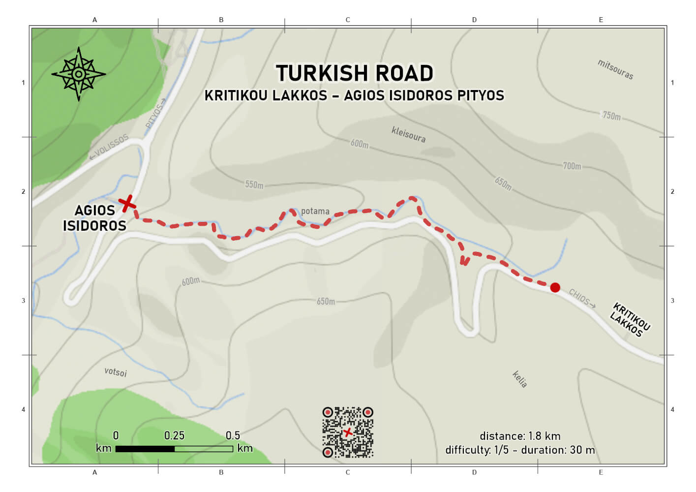
'Turkish Road'
difficulty 1/5
distance 1.8 km
ascent 0 m
descent 138 m
duration 00:30
point to point
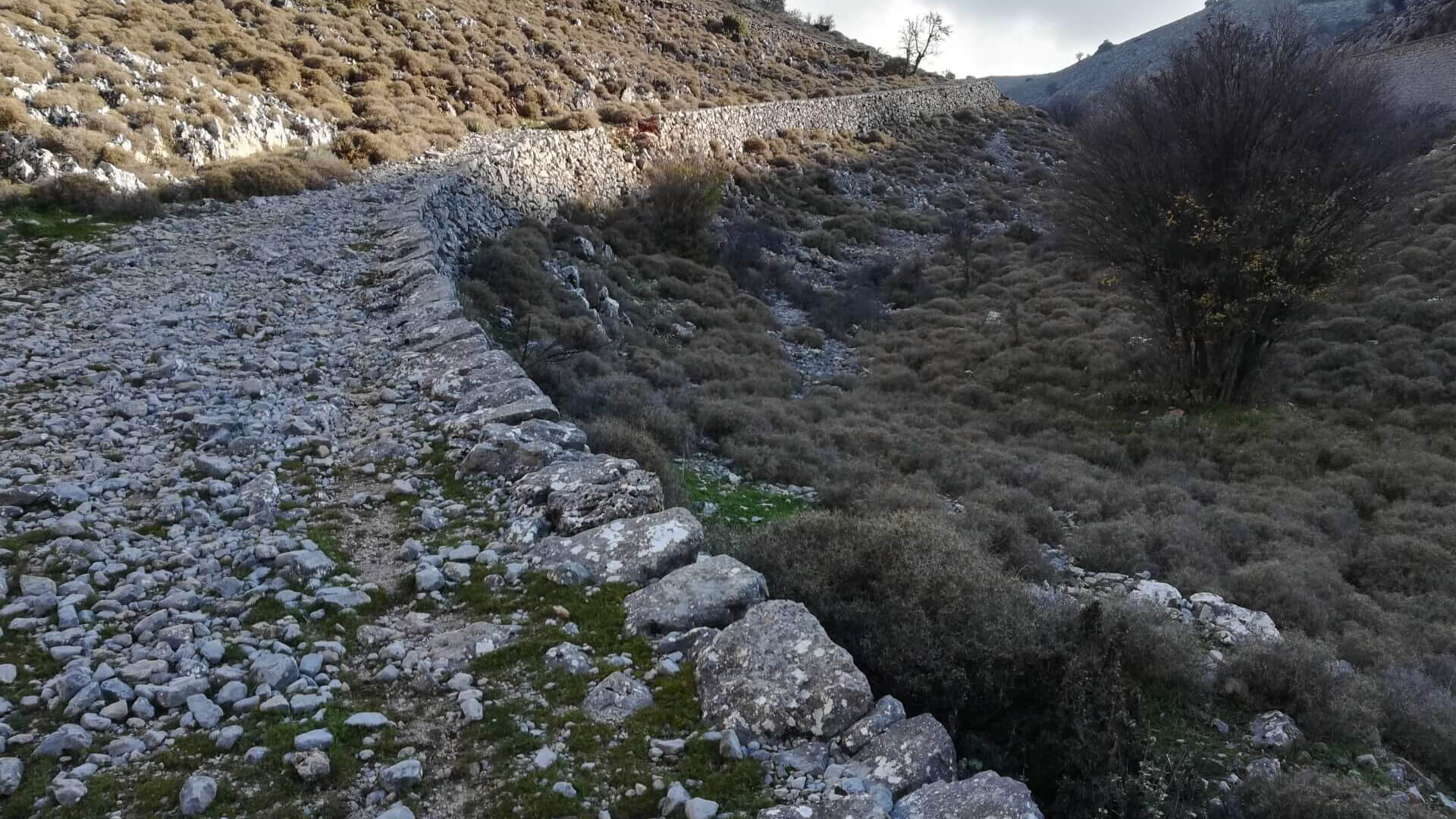
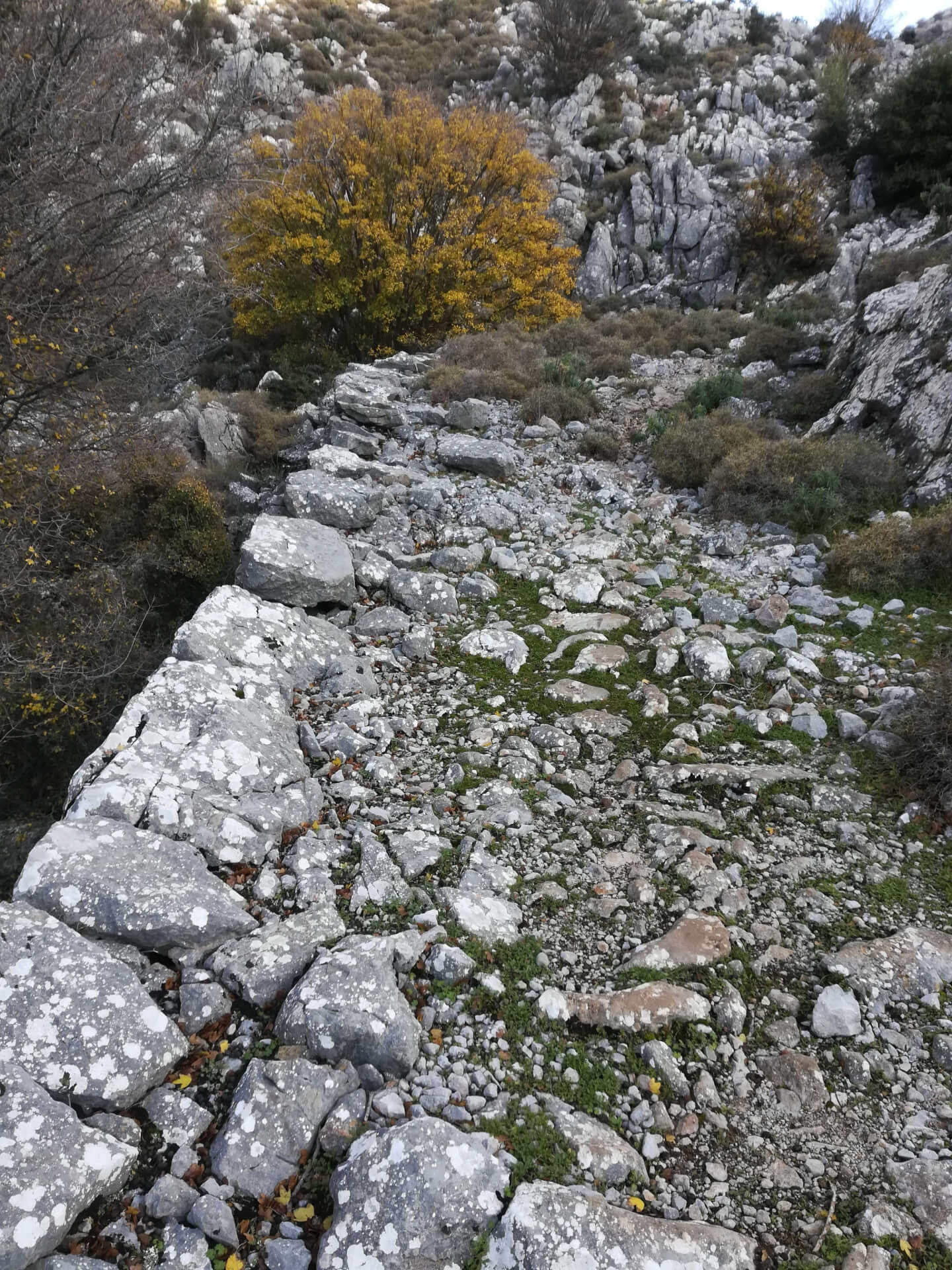
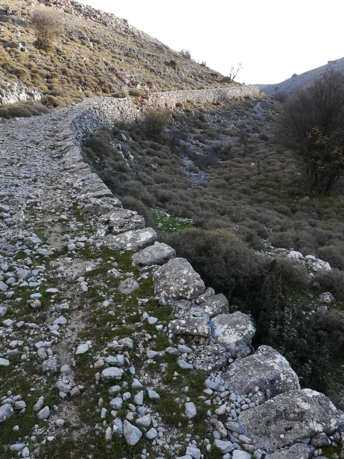
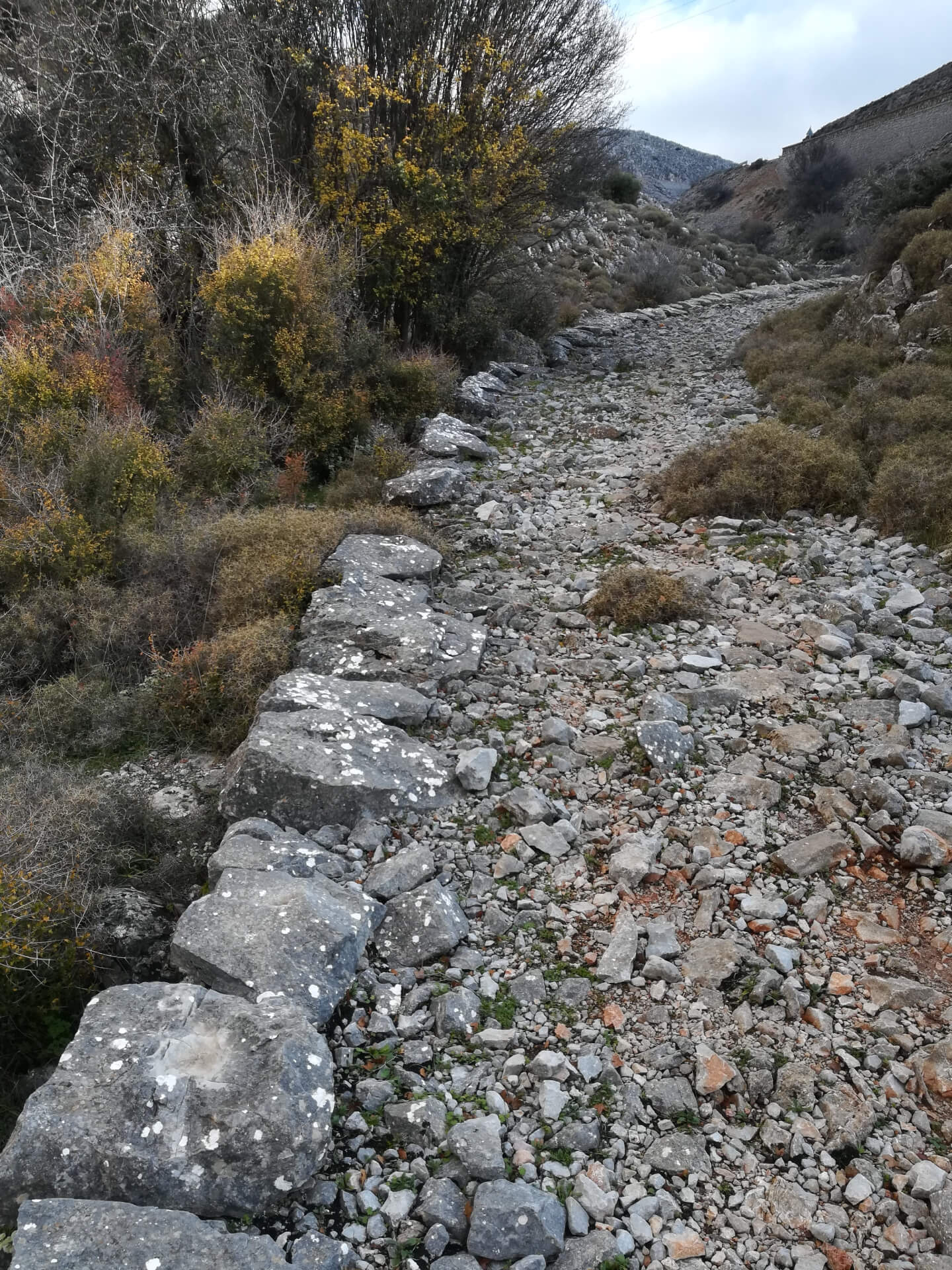
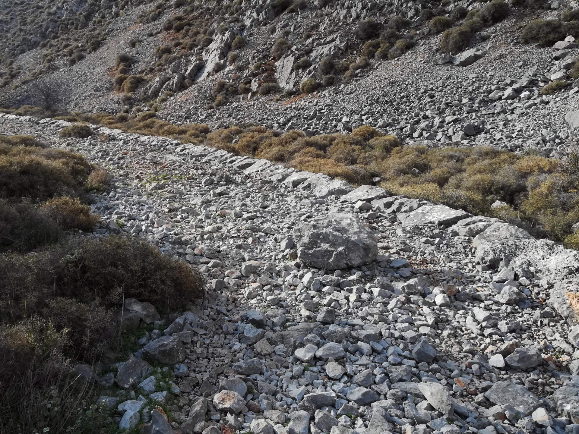
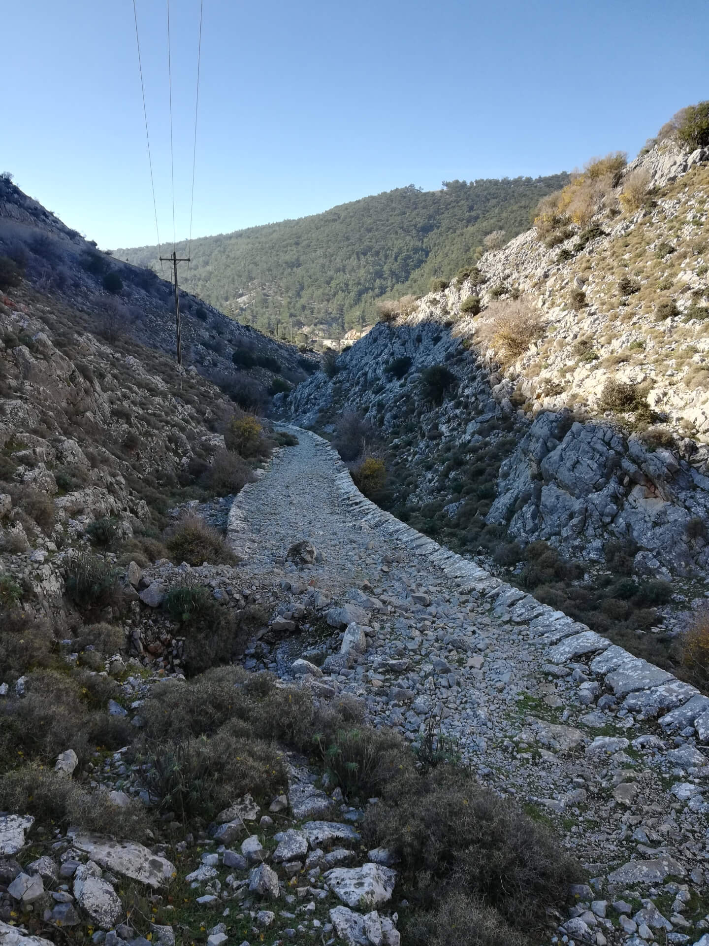
Short downhill route along a well-preserved section of the so-called “Turkish Road”, an impressively built carriage road dating back to the Ottoman period, which once connected Aepos with the village of Katavasi. The route begins just past the location known as “Kritikou Lakkos” and runs parallel to Potama, the seasonal stream that flows down to Agios Isidoros of Pityous.
Although most of the trail is covered with small stones, it is suitable for a relaxed walk for families with children, as it is generally easy to follow. Only in a few spots—due to rockfalls and deposited debris—is a bit of extra caution required.
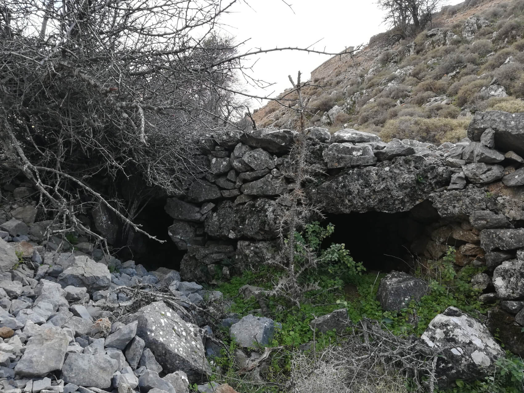
The starting point of the route is located on the right side of the Chios–Keramos provincial road, heading north, approximately 650 meters after the junction to Anavatos. From there, you enter the old carriage road, which descends gently all the way to Agios Isidoros of Pityous. The Turkish Road has a serpentine layout, is about 4 meters wide, supported along its entire length by dry-stone retaining walls, and features a small bridge at the point where it crosses Potama.
Please note that at the end of the route, in Agios Isidoros of Pityous, there is a café-restaurant. If you have not arranged transportation for your return and need to make your way back to the starting point on foot, allow for additional time, as the ascent will be more demanding due to the 138-meter elevation gain.
Last update February 26, 2026
NEED SOME HELP?
Download the route track to your phone in GPX or KML format, grab the static map in PDF,
gather your company, and set off for the Turkish Road.


⚠︎ THE INFORMATION REFLECTS THE CONDITION OF THE ROUTES AT THE TIME THEY WERE RECORDED ⚠︎
However, trails are dynamic and may change over time. If you notice anything that you believe needs correction or updating, please write to us using the contact form. In the subject line of your message, include the name of the route, and in the body, describe the issue you would like us to take into account. Your help is greatly appreciated in keeping trail information accurate and up to date.